Feel free to share
 Using this site means trees will be planted. ^.^
(Find out more)
Map creation guide part 1: Map Types & Tectonic Plates
Crafting a realistic map of a fantasy world is difficult. Worlds behave according to laws of nature and they're all too often ignored for the sake of a simpler work flow or to make sure a specific geological element is part of the map. But you can have the best of both worlds, all it takes is a little upfront research to know how to apply everything in a realistic manner. This guide will help you do just that.
At the time of writing this, the guide won't be complete yet. There's a whole lot to cover from tectonic plates to prevailing winds, from river systems to climate zones, and far, far more. So over the next few weeks (potentially months) you'll see this guide grow and grow and grow. I'm hoping to be able to cover anything you could wish for, including lesser important parts like where in the world you'd find mineral deposits, likely trade routes sailing ships would take, how a civilization might expand across a world, and so much more. But let's not get ahead of ourselves just yet.
This first part will cover types of maps (and why they may be of importance to consider) and tectonic plates. I'll do my best to keep the technical terms and descriptions to only the necessary and focus primarily on showing you the processes involved in creating a realistic map. I'll add technical terms and names in brackets for those who wish to do further research).
While nothing I'll do requires anything more than paper, pencils, an eraser and maybe a ruler, everything does become a lot easier if you have access to an image editing program with layers and a drawing tablet of sorts.
Map Types
This first part is a bit long and info heavy, but there's a TLDR section further below if you want to skip this.
Putting the surface of a globe on a 2D surface is more difficult than it may seem. The rectangular world maps we're all used to seeing are distorted versions of what the world actually looks like due to the way a globe's surface needs to be stretched in some places and squashed in others in order to fit. There are countless ways of projecting a globe on a plane, but every one of them will have some distortion. With this in mind it's possible to craft maps dedicated to a specific property of the world's surface, which in turn is helpful for various different purposes (think navigation vs dividing farm land, for example).
So, which one should you choose? Most people are familiar with either one or two types: conformal and equal-area maps. Conformal maps preserve angles, equal-area maps preserve area. What this means is that on a conformal map you can draw a straight line, and if you were to travel from point A in the compass direction of point B, you would reach it.
Equal-area means any one part of the map has the same proportions as any other part of the map, but to achieve this the shape of the world has to be distorted in specific parts, so you can't do the line trick you can do on a conformal map.
What does this mean from a map creation point of view? Comparing a popular conformal map (Mercator) with a popular equal-area map (Hobo-Dyer) shows the conformal map to have almost no distortion at the equator, but the further you go away from it, the more the map is distorted (on these maps Greenland looks like it's the size of Africa, in reality Africa is 14 times bigger).
The equal-area map instead picks two lines of no-distortion and the further you go from them, the more distorted the world will be, but because of the double lines, never as much as the conformal map. So an equal-area map looks more like reality.
With this in mind, I prefer equal-area maps by far as they make other world building aspects simpler. But, if I were to create a map from the point of view of a world explorer, a conformal map would be my choice. Don't worry though, it's possible to transform one map into another type with image editing software with a feature for distortion to stretch and squish the image.
Different equal-area maps have different distortions and aspect ratios. I prefer the Hobo-Dyer version purely from an aesthetic point of view. Its ratio is 2:1 (width:height). Others include Gall-Peters (1.57:1), Lambert (π:1) and Tobler (1:1).
Below are two rectangles with the distortions as circles (Tissot indicatrix) and in their respective ratios. The first is Gall-Peters, the second Hobo-Dyer.
There are far more map types, many of which aren't on a rectangular plane. I'm ignoring these for now for the purposes of this guide as they're more difficult to work with from a paper and pencil only point of view.
TLDR - Map Types
There are a lot of different map types, each with different distortions, so the world never looks 100% correct on a map. Equal-area maps preserve area (so everything is relatively in proportion and Greenland doesn't look like it's the size of Africa), so we're using this type for the purpose of this guide.
Planet Type
A quick note before we start drawing: consider the type of planet you wish to create. I'll delve into more details later in this guide, but creating an Earth-like planet verus one who isn't will potentially differ immensely in how you go about creating it. Some of the aspects this choice will affect are:
- Tectonic plates (and thus mountain creation, earthquakes, etc.).
- Rotational speed and direction (affects prevailing winds).
- Ocean sizes/amount of water (affects weather).
- Planet's mass (affects gravity and therefore tides, mountain heights, etc.).
For the purposes of this guide, we're creating an Earth-like planet's map. In the future I might add maps for other types of planets if enough information is available on their formations.
Tectonic Plates
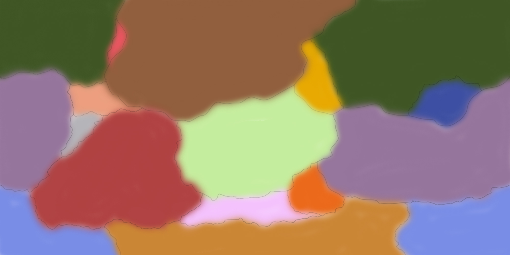
It's time to start drawing, so grab whatever you need and let's get started. First up are the tectonic plates, they're the moving parts of Earth's crust and responsible for a whole range of geological structures and events. We begin with the major plates, which, on Earth, are plates with an area greater than 20 million square km (this is an arbitrary number purely meant for grouping tectonic plates). Present-day Earth has 8 of them (7 if you count the Indian and Australian plates as one), but you can create as many as can fit on your planet's surface or as little as one super-continent like some of past-Earth's (potential) supercontinents.
Make sure you never have 4 plates meeting at a single point, however. So the lines will always look like either lines or T-junctions. While it is theoretically possible for 4 plates to touch at a single point, this is very rare and never lasts long.
One thing to keep in mind is that Earth's biggest plate is the Pacific Plate, an ocean plate. Your world doesn't need to have such a large oceanic plate nor does the biggest have to be an oceanic one, but it's worth keeping in mind, if you want to mimic Earth closely.
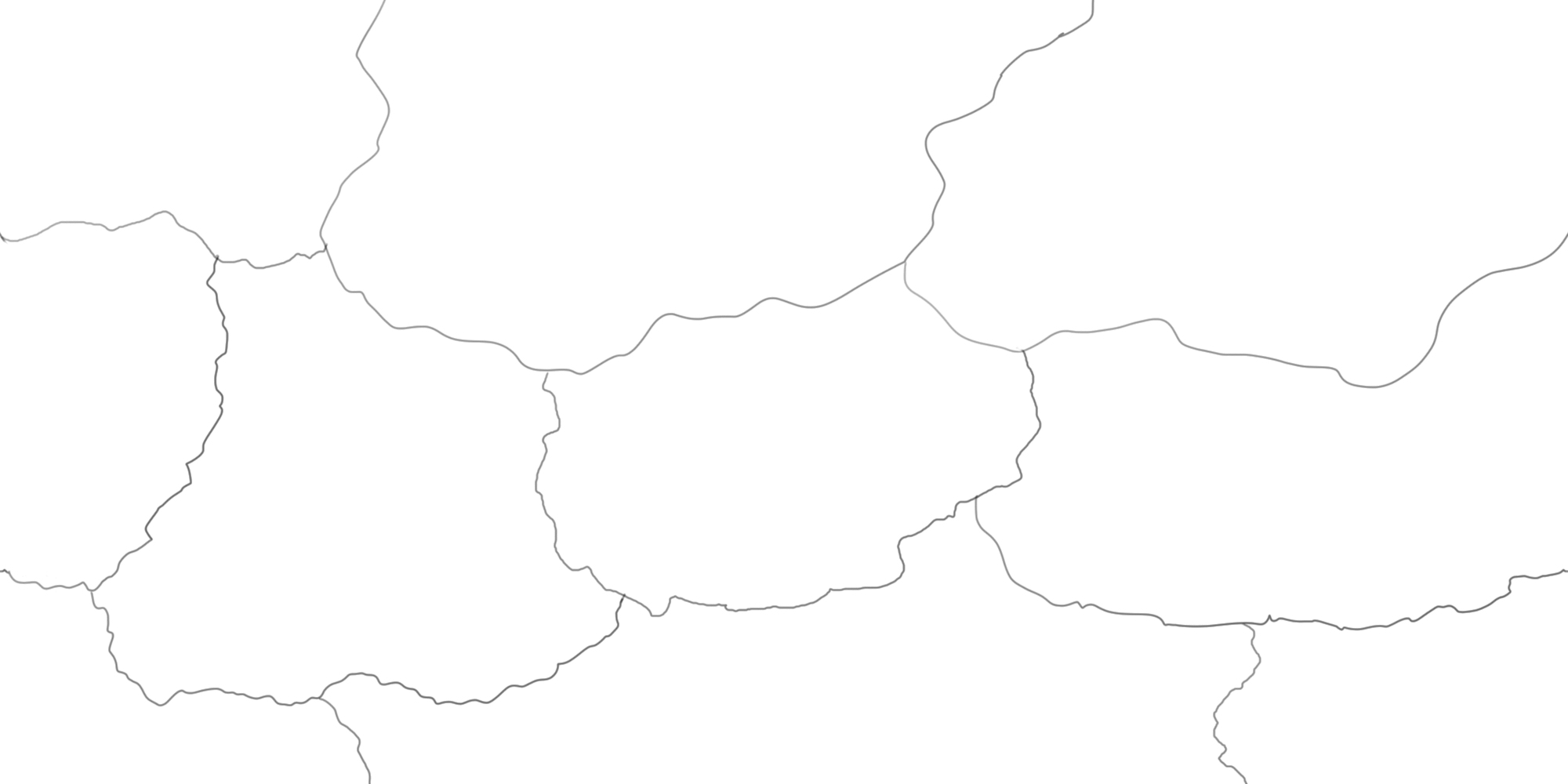
Next up we add some minor plates. These are less than 20 million square km and more than 1 million square km in size, and present-day Earth has 15 of them, but you can again create as many as you wish.
I added only a relative few to create more borders (which is where the fun stuff happens), but I can change a lot later down the line by adding some smaller minor plates or even some microplates.
Present-day Earth has over 50 microplates (science and Earth's crust continue to evolve on this), which could add some details here and there or be used later down the line to explain islands you may wish to have. For example, the Seychelles are on a microcontinent, and there are a bunch of microplates in the Pacific in Southeast Asia.
Some of you may be tempted to plan out a rough world in this stage. Mountain range here, some hills over there, volcanoes over there, and so on. My advice is to wait with this until at least the climate stage of our map creation. Alternatively, make sure you have a varied map if all you want is a diverse world. If you want to nudge your world to look a certain way, using climate goes a long way and a misplaced mountain range can quickly ruin this.
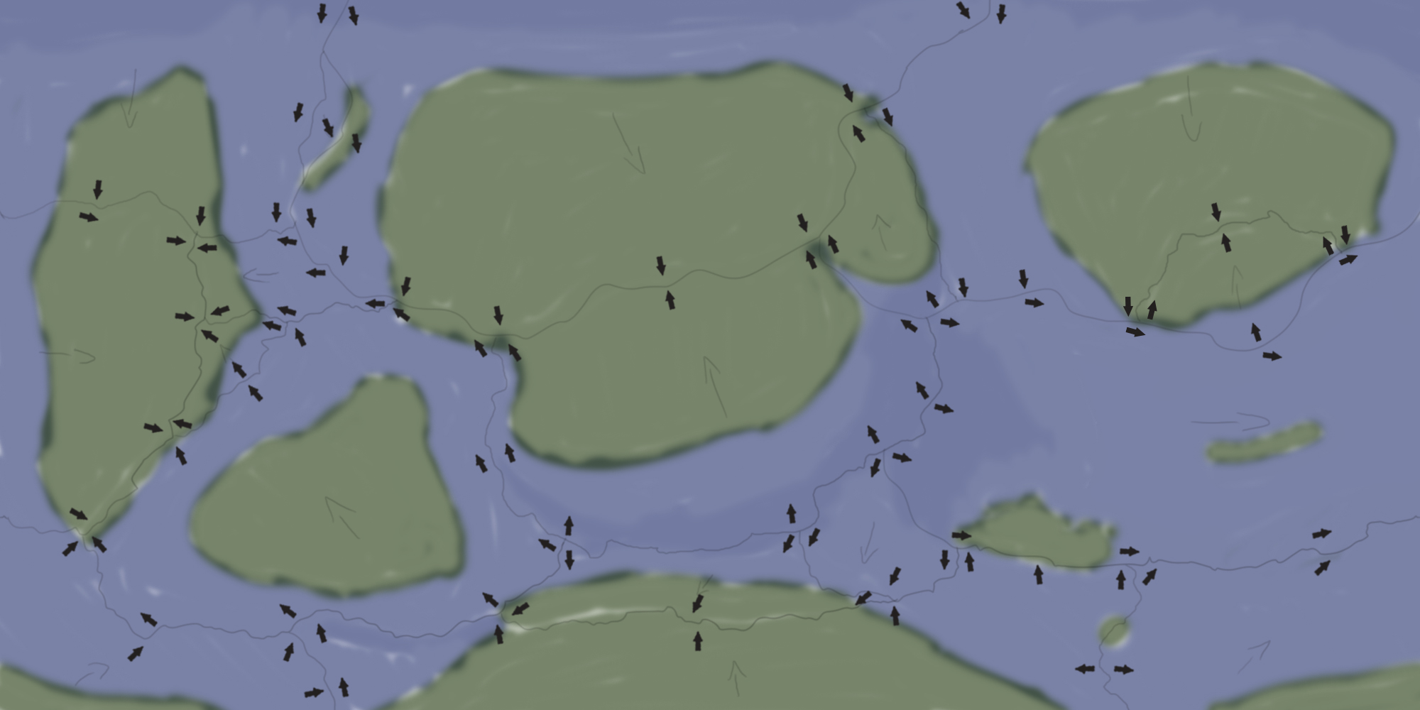
Note that lines going west or east off of the map need to meet up on the opposite side. This isn't the case for lines going north or south, they all end up on the northern and southern most tip of the globe (after accounting for distortion). In the image below each plate has a different color. You can see the dark green, lavender and light blue plates cover both ends of the map in a horizontal direction.
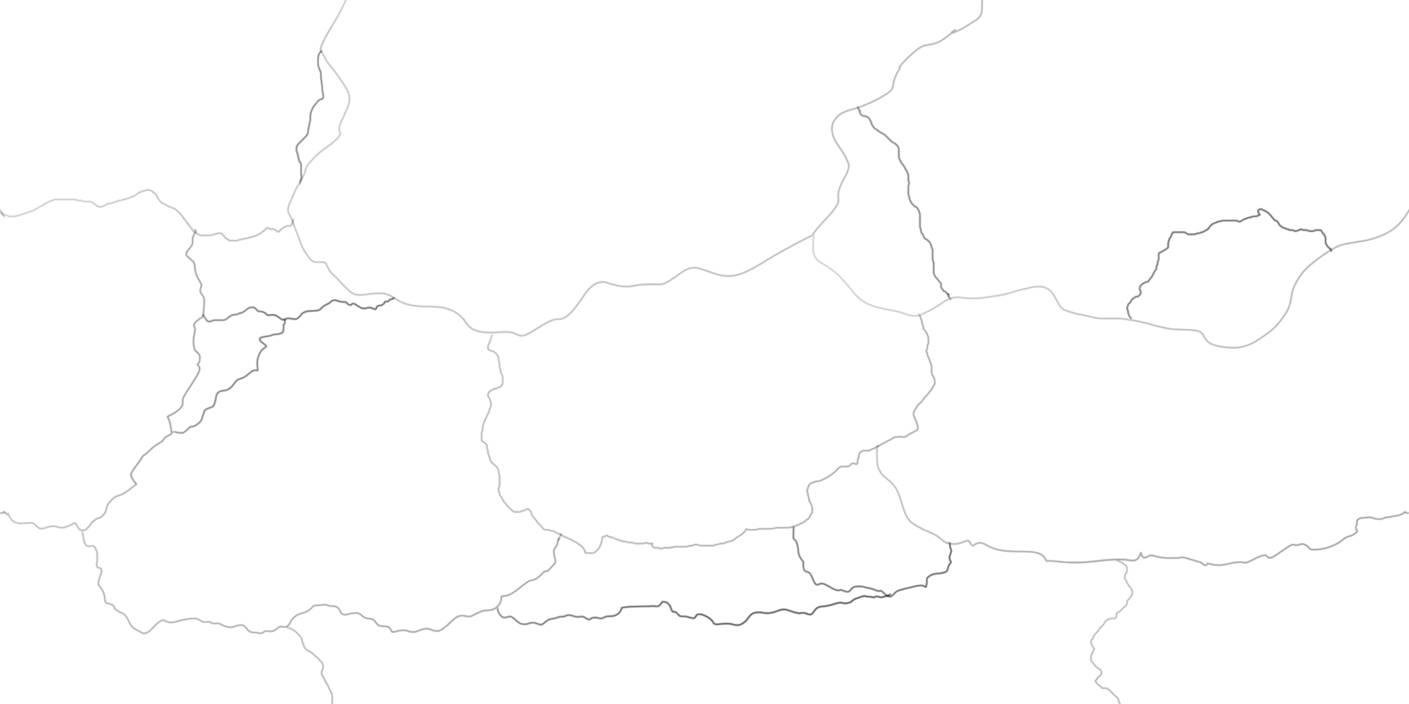
Movement & Boundaries
After you've got your major and some minor plates drawn it's time to give them movement. All plates move in a direction (and can rotate as well), meaning they either crash into each other, slide against each other or move away from each other. So, with oceanic and continental borders, we can have a total of 9 theoretical boundaries:
Divergent (they move away from each other and thus create rifts):
- Ocean-to-ocean: This obviously happens underwater and creates new ocean floor in the process. Examples on Earth: Mid-Atlantic Ridge and East Pacific Ridge.
- Continent-to-continent: This rarely exists for long (relatively speaking) as water will usually fill the rift created by the splitting away of two continents and thus create a continent-to-ocean border.
- Continent-to-ocean: If the edge of a plate happens to be above the water surface, this would last, but usually these borders collapse and thus end up underwater, turning it into an ocean-to-ocean border.
Convergent (they crash into each other and could create mountains):
- Ocean-to-ocean: The cooler and denser plate will sink beneath the warmer and less dense plate. It usually creates little volcanic island arcs* and it creates trenches like the Mariana Trench.
- Continent-to-continent: This creates mountains over millions of years.
- Continent-to-ocean: The oceanic plate sinks under the continental plate, creating volcanic arcs*.
*These arcs are not like Hawaii, this is a different mechanism (covered later). Instead this is what created, among others, Japan and the Philippines in the case of ocean-to-ocean convergent zones, and the Andes in case of continent-to-ocean convergent zones.
Transform (they slide passed each other and cause earthquakes):
- Ocean-to-ocean: Could create island chains like the Aleutian Islands between Russia and the US as a result of volcanic eruptions.
- Continent-to-continent: Results in hilly, almost wrinkly landscapes and/or strange rock formations if enough time has passed for erosion to have taken place. Prime example is the San Andreas Fault.
- Continent-to-ocean: Usually similar to the continent-to-continent border, just with parts hidden by the water.
The easiest way to start this process is to either make two continental plates crash into each other or two oceanic plates move away from each other. With the above information in mind, you can thus create either a first land mass with mountains where the crash happens, or an oceanic ridge where the separation happens. From this point onward you can make all the other plates move in other directions to create interesting dynamics where you wish them to be.
I started with moving two plates away from each other (the lavender and light green one in the color image from earlier), and made one of these moving plates crash into another.
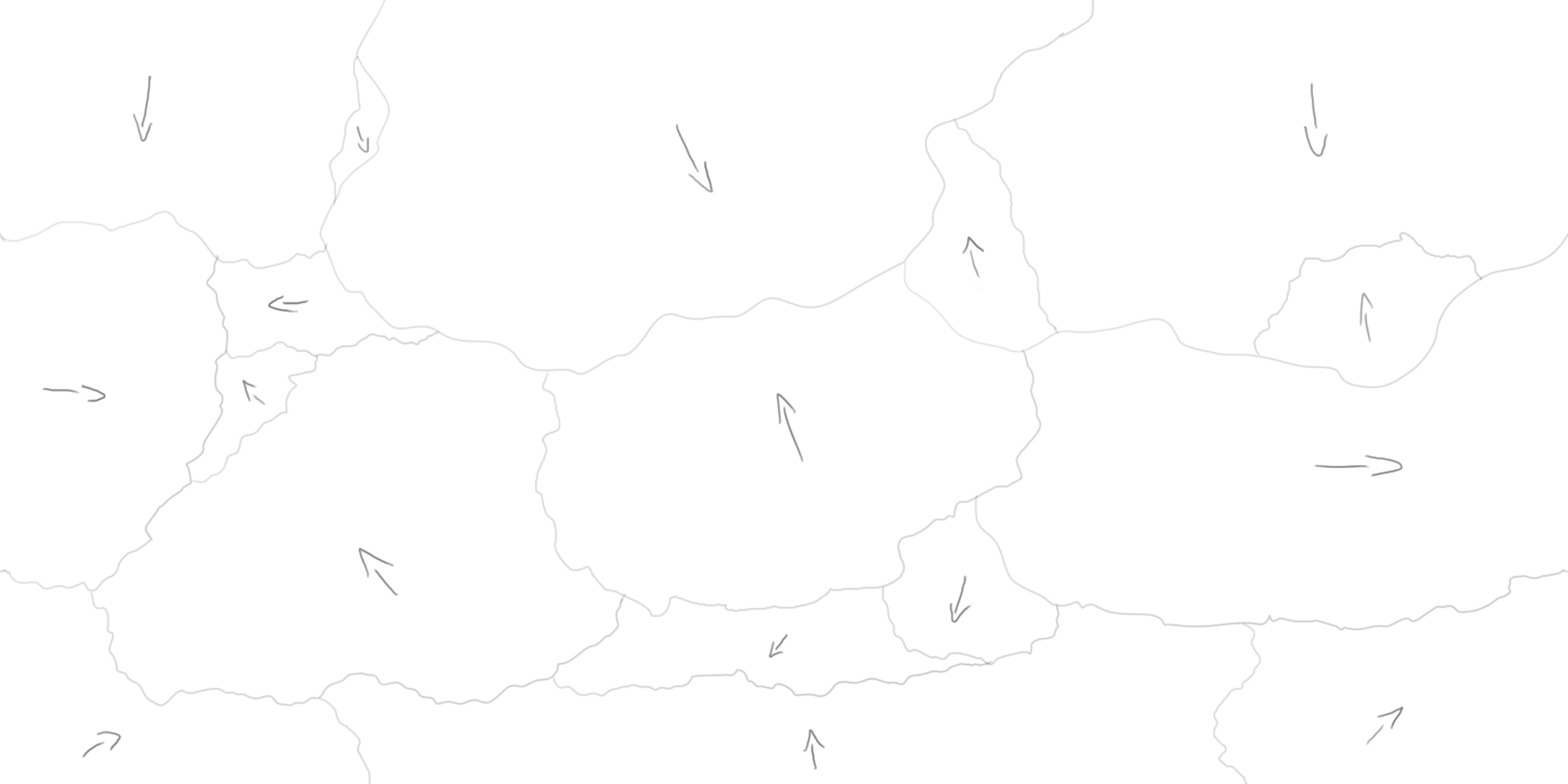
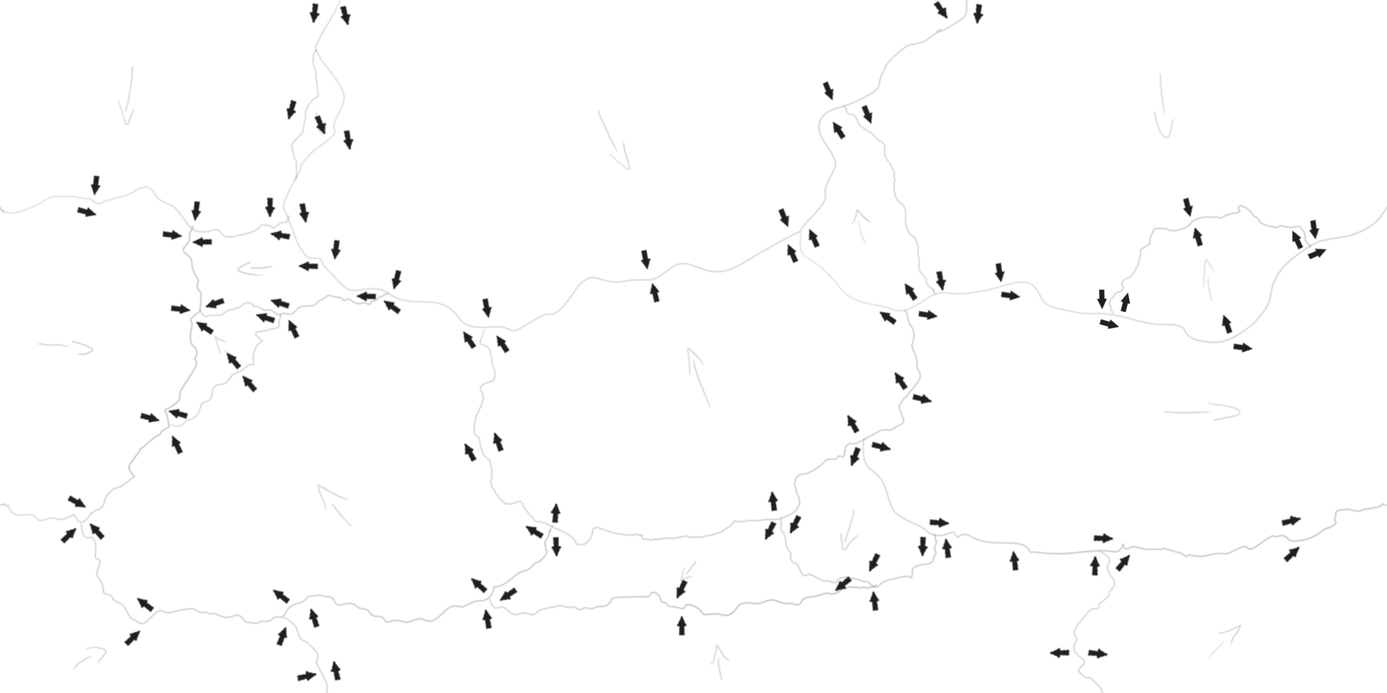
After you've given all of your plates a directional movement, check if there are any you wish to change. After this, you can add little arrows on all the borders to help visualize the different boundaries from before as seen in the image below. Keep in mind that plates rotate, so if some borders seem too plain or too confusing, visualizing a rotation could help you. Also keep in mind that plates aren't homogeneous. Different thicknesses, rock types and other elements can play a role in how one part is pushed differently than another, even on the same plate.
At this stage you can make changes very easily. If you happen to lack a certain type of border or simply want more of a specific kind (perhaps more mountain forming convergent boundaries), simply change a plate's movement or add in a few minor plates. Nothing is set in stone yet, and we will be adding more features later down the line as well. But for now let's focus on this current stage.
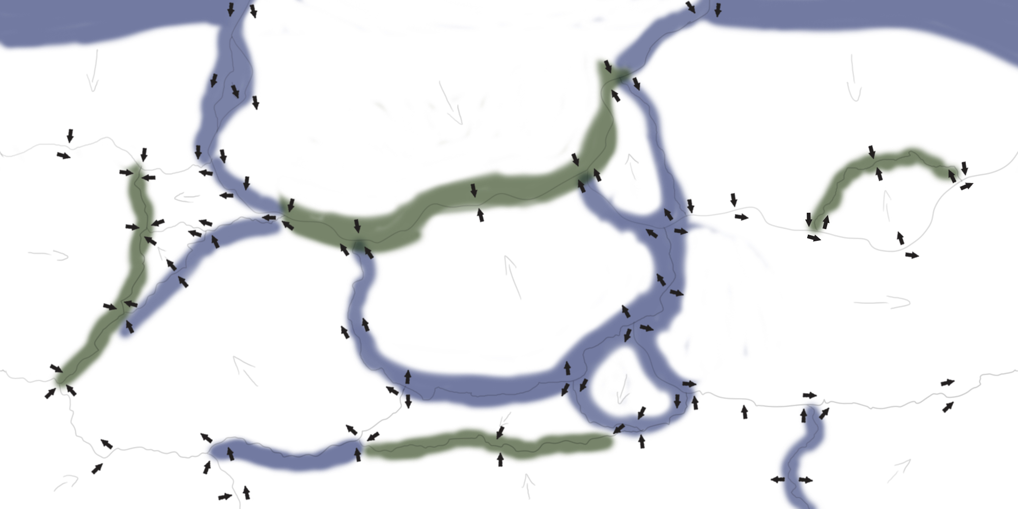
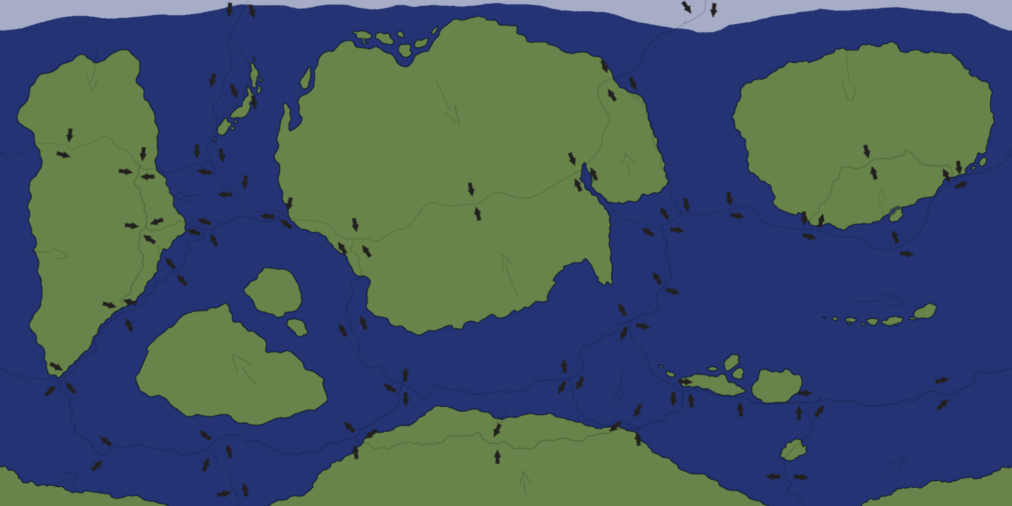
With the different boundary types in mind, I first colored some of the borders where I know I'll want land and where I want ocean. This gave me a good overview of what the world map could potentially look like. Immediately it's clear there will be at least 4 continents (unless I make some meet up as one larger continent), so if 4 isn't enough, I can add more.
The long line of blue near the center is ideal for an oceanic ridge, and the majority of the right side of the map would work well as a large ocean, perhaps with some island chains akin to Hawaii.
Now I can fill in everything as a rough draft to visualize the world in terms of areas of land and areas of water. As you can see I've already added a few spots for islands at this stage, but more can and will be added later down the line.
The little blob of land in the middle of the ocean on the right hand side is an island chain similar to Hawaii. Hawaii is the result of a volcanic hotspot, which is something not yet fully understood by science. But it essentially boils down to magma pouring out off the Earth's crust in a specific, thought to be extra hot spot (hence the name), which causes a volcano to be created. As the plate moves over the hot spot, a new volcano will be created when the first has moved too far away. If this happens in the ocean, a chain of islands appears. If this happens under a continent, you get something like the Yellowstone hotspot of today.
Iceland also has a hotspot, but also lies on a divergent border. Part of the volcanic activity is because of this border, but since Iceland is the only island on this ridge (and very large), science thinks a form of hotspot is responsible for its growth. What type of hotspot is debated.
I put an Iceland-like island on my map, near the bottom on the right side.
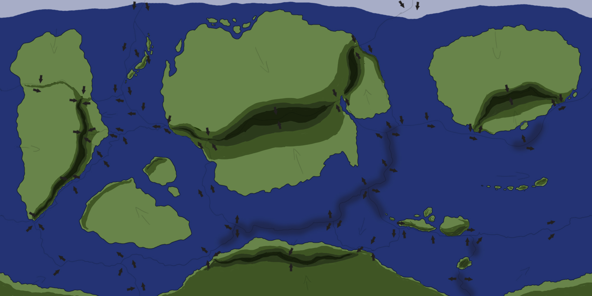
All there is left to do now is clean things up a little to get the first, flat draft of my new world as seen in the image below. I've included an Antarctica-like continent in the south and ice caps in the north to mimic the North Pole for the purposes of simulating a present-day Earth-like climate during the later stages. I've also added a couple of islands, cut one of the continents into pieces, and created a small tear in another (similar to the tear between the Arabian and African plate in present-day Earth).
If you cut a continent into pieces, you could choose to add more minor plates to explain this rift and create more borders, but it could also simply be the result of tectonic activity hundreds of millions of years ago, or because of erosion or similar factors in the past.
After this stage I made a first, preliminary height map to show what my future mountain ranges might look like. This'll help me with the climate stage coming up soon, but also helps me visualize what the final map may look like. Because I want a lot of mountain ranges on my map, I added mountains on every convergent continent-to-continent border. Note that it is not a must to have mountains on these borders, it takes millions upon millions of years for mountains to be created, so if you don't want mountains on a particular border of this type, simply count it as a recent collision, so mountains haven't had time to be formed yet.
As mentioned before, science doesn't know the full story yet, so it is possible to add more mountain ranges in some other spots of your map. For example, the Scandinavian Mountains. Science isn't entirely sure how they formed, and they're not on a convergent zone. Mimicking them can go a long way to adding a realistic mountain range away from a convergent zone.
In the next part (coming soon), I'll cover winds, climates, ocean currents, and more. After that I'll likely delve into how to stylize your map in different ways, but we'll see. There's a lot of work still be done, so stay tuned.